Latitude delivers GIS and remote sensing services that meet donor standards, enable faster approvals, and provide the accuracy agencies and enterprises need to reduce risk across the Caribbean and LATAM.
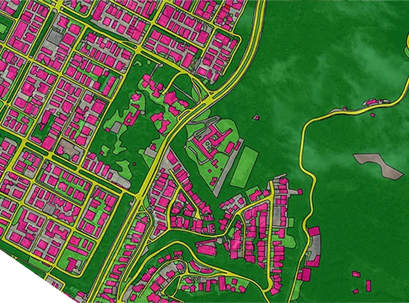
Governments and enterprises face delays, cost overruns, and compliance gaps when spatial data is incomplete or outdated.
Without reliable GIS baselines, infrastructure plans stall, agricultural programs misallocate resources, and environmental projects struggle to meet donor reporting thresholds. Agencies need spatial data that is accurate, transparent, and aligned with international standards.
Latitude provides end-to-end GIS and remote sensing services — from base mapping and land surveys to advanced satellite and UAV-derived datasets.
Sub-5 cm precision for infrastructure and compliance projects.
Satellite, UAV, and LiDAR sources integrated into GIS for real-world decision-making.
50+ projects across Guyana and the Caribbean in government, energy, mining, and environment.
Used in national planning and disaster-readiness programs across multiple ministries, supporting post-disaster mapping and infrastructure resilience planning.
Collect multi-source data (satellite, UAV, LiDAR, hydrographic).
Convert raw datasets into GIS-ready layers with quality checks.
Deploy decision grade maps and dashboards with training for client teams.
Monitor crop health, forecast yields, and support climate-smart planning.
Map corridors for pipelines and transmission lines with compliance-ready records.
Support planning, construction monitoring, and compliance reporting.
Track erosion, wetlands, and habitat changes with reliable evidence.
Map shoreline change, ports, and coastal resilience projects.
Support cadastral updates, land use planning, and disaster response.
Monitor crop health, forecast yields, and support climate-smart planning.
Map corridors for pipelines and transmission lines with compliance-ready records.
Deliver site surveys and asset maps for roads, ports, and utilities.
Track erosion, wetlands, and habitat changes with reliable evidence.
Map shoreline change, ports, and coastal resilience projects.
Enable cadastral reform, zoning, and disaster response mapping.


Latitude delivers platforms that withstand audits, meet regulator standards, and prove outcomes in the Guyana and Caribbean.