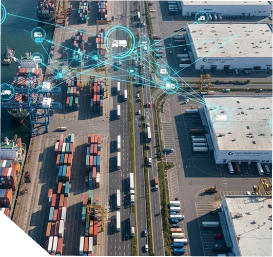
Latitude FleetTrack unifies telematics and geospatial intelligence to give managers total visibility over vehicles—location, mileage, fuel use, driving behavior, hours, and order status—at any scale.
You can’t manage what you can’t measure.” Without live location, driver behavior, and fuel analytics, fleets suffer route inefficiencies, higher fuel spend, safety incidents, and compliance gaps.
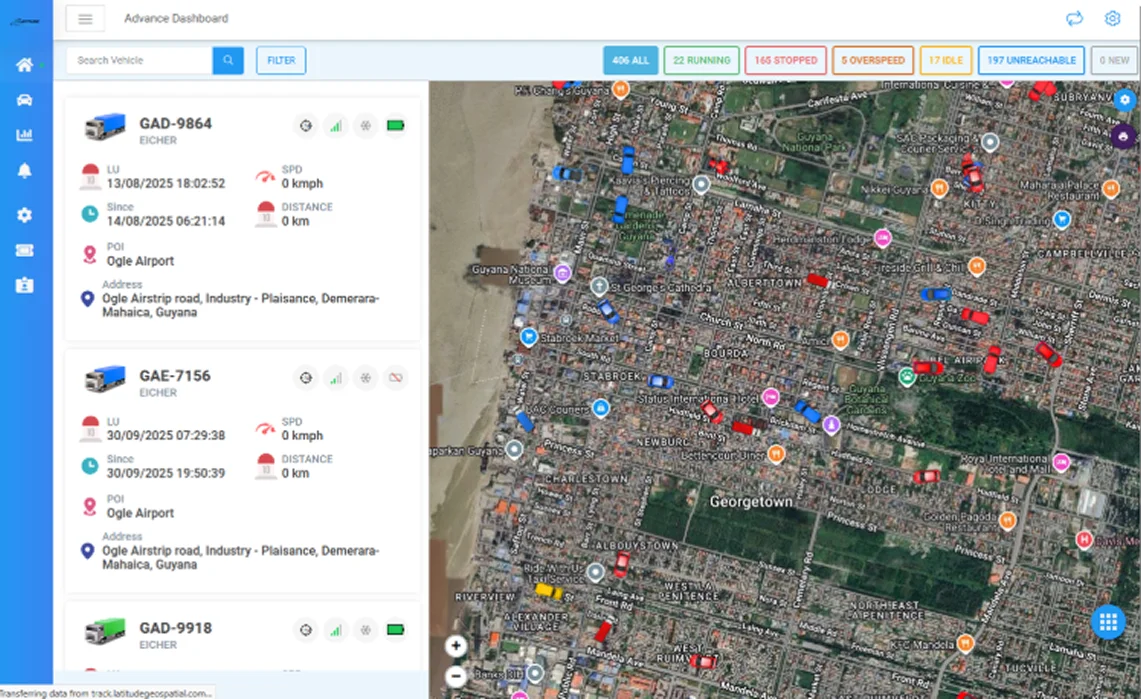
Latitude FleetTrack connects office teams to vehicles and drivers through maps, dashboards, and reports. With real-time tracking and monitoring, managers can optimize routes, reduce fuel costs, improve driver safety, and raise overall fleet productivity. The platform is available on Android and iOS for on-the-move visibility and control.
Plan alternates during congestion; meet ETAs; lift customer satisfaction.
Monitor speed, behaviors, and geofence adherence; keep audit evidence.
We review denied claims and recover lost revenue.
Live location and trip status for every vehicle.
Six-month archive with playback and text/graphical reports for incident review.
Virtual boundaries, deviation and speed-limit alerts.
Reports to spot consumption anomalies and savings opportunities.
Detect harsh acceleration/braking, overspeeding, excessive idling.
Detect harsh acceleration/braking, overspeeding, excessive idling.
50+ configurable notifications; custom reports supported.
Android/iOS apps for managers and drivers.
24×7 livestream, automatic/manual archiving, and notifications for 60+ events.
Driver scores, event reports, real-time violation alerts, Hours-of-Service monitoring.
Waypoint prioritization, route-deviation alerts, ETAs and Proof-of-Delivery, trip management.
Firmware/protocol agnostic; AIS-140 GPS devices; ELD-friendly.
Asset trackers, AVL devices, eLocks, fuel sensors, OBD GPS, personal/pet trackers, video devices.
Access management, announcements, driver management, technician app with scoped permissions.
Orchestrate last-mile routes, monitor delivery fleets, and reduce late arrivals.
Maintain fleet accountability, leverage history playback for incident investigation.
Improve safety and compliance across public fleets with geofenced oversight.
Maintain fleet accountability, leverage history playback for incident investigation.
Improve safety and compliance across public fleets with geofenced oversight.
from the Guyana Manufacturing & Services Association for innovation supporting transport, mining, and infrastructure.
ensure accurate geospatial mapping and compliance reporting.
Including AIS-140 and ELD-friendly systems.
for compliance, efficiency, and public-safety oversight.
Latitude supports national and enterprise programs with defined delivery standards, secure data systems, and technical services designed to meet audit, regulatory, and operational requirements across Guyana and the Caribbean.