Latitude Geosense automates drone data capture, visualization, and analytics—helping teams plan better, construct faster, and sustain longer. Anywhere. Anytime
Worksites face delays, compliance risks, and escalating costs when monitoring is manual or based on outdated basemaps. Without accurate, repeatable spatial intelligence, organizations struggle to track progress, ensure safety, and maintain transparency with regulators and donors.
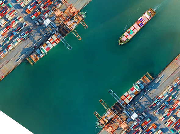

Latitude Geosense is an integrated drone data platform that automates the entire process of worksite insight generation—from flight planning to reporting. Using open-source satellite data, it identifies boundaries, creates autonomous flight missions, and builds digital twins of assets in both 2D and 3D. With AI-powered analytics, users can track construction progress, assess asset health, and generate audit-ready reports—all within a secure, cloud-based environment that scales effortlessly from one to hundreds of sites.
Generate safety and progress reports with one click, supporting transparent oversight.
Access accurate models of worksites to monitor change, volume, and condition over time.
Empower teams with live visualizations and actionable data that cut review cycles and improve coordination.
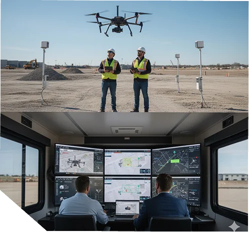
Automatically plan and execute missions to capture complete site coverage.
Automatically plan and execute missions to capture complete site coverage.
Identify construction progress, asset degradation, and compliance gaps early.
Produce drone-powered safety, maintenance, and issue reports instantly.
Translate data into context—so teams, regulators, and partners can act faster.
Constant uptime, data security, and integration with standard formats (GeoTIFF, DXF, DWG, KML, KMZ, JPEG, TIFF, DXF, LAZ).
Every dataset vetted by domain experts to ensure reliability.
Always-on operational and product assistance for continuous workflow uptime.
Monitor excavation volumes and verify permit compliance.
Track infrastructure projects and update planning data in near real time.
Detect environmental change and prepare resilience or disaster models.
Manage project timelines and validate contractor performance.
from the Guyana Manufacturing & Services Association for innovation supporting transport, mining, and infrastructure.
ensure accurate geospatial mapping and compliance reporting.
Including AIS-140 and ELD-friendly systems.
for compliance, efficiency, and public-safety oversight.
Latitude supports national and enterprise programs with defined delivery standards, secure data systems, and technical services designed to meet audit, regulatory, and operational requirements across Guyana and the Caribbean.